Safer Streets Initiative 2026
Reducing road speed increases safety for everyone.
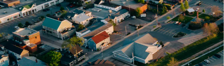
Over the next months, as part of our Safer Streets Initiative, we will be piloting several traffic safety interventions in different areas around Town.
Some of these interventions involve safer pedestrian crossings, painted lines, speed cushions, changes in lane width and, the use of flex posts (bollards). Each of these interventions will be assessed to determine if they effectively reduce speeds and increase safety.
To prepare for this work, the Town has been working with Mobycon, a Dutch-based consulting firm. Together, we have identified opportunities to reduce vehicle traffic volumes and speeds, so we can make Wolfville’s streets safer and more enjoyable for all users.
A short survey is linked below to help the Town understand traffic safety issues in Town. Thank you for participating in this process. We look forward to your important feedback.
What happens now?
With the support of Town Councillors, letters will be delivered in early June to households along Stirling Ave, Skyway/Pleasant St, Sherwood Dr anat the intersection of Orchard and King St. These letters can be viewed on the right under the "Letters to Residents" tab. View some proposed changes for these streets below.
Through the spring and summer, staff will be working to launch these localized pilot projects. Watch this site for project updates!
East Town Gateway:
- A Speed Table will be installed at the entrance to Town on east Main Street, near the Wolfville sign. The speed table helps encourage safer driving speeds of 40-50 km per hour and makes the transition from the rural area of Highway 1 to Wolfville Main Street.
- A marked crosswalk will be painted, with a bollard in the centre lane to improve visibility for pedestrian crossing at Woodman Road.
 Orchard Ave, King St and Millennium Trail Intersection:
 - In 2026, painted curb extensions with bollards will be applied to the corners of the intersection to improve visibility, encourage slower driving and make it safer for pedestrians to cross the street..
- A crosswalk from the Rotary Park parking lot to the Millennium Trail entrance will be painted.
- A new all-way stop control will be installed
- In the longer term, civil works to make the curb extensions permanent and improve the crosswalk connection will be considered.

Sherwood Drive and Millennium Trail Crossings
- In 2026, lane shifts will be painted on the length of the road to slow traffic approaching the crosswalk.
- A centre median bollard will be installed to improve visibility of the crosswalk.
- In 2027, civil work to add concrete sidewalk connections will be complete.
- in the longer term, further civil work will be considered to make the curb extensions permanent and improve crosswalk connections.

Sherwood Dr, Pleasant St and Reservoir Park Parking Lot
- Improvements to slow traffic near the Reservoir Park parking lot will create a safer environment for all road users.
- In 2026, a new all-way stop will be installed to slow traffic in the area.
- Sightlines will be improved by removing one parking space in the parking lot.
- A marked crosswalk with bollards will be implemented.
- A marked crosswalk with bollards will be added to the parking lot to improve pedestrian safety.
- In the long term, a section of land at the corner of Sherwood and Pleasant St is available for a public space improvement or placemaking opportunity.

Stirling Ave, Main St and Whidden Ave intersection
- In 2026, a new crosswalk with centre lane bollards will be installed from the east side of Stirling Avenue across Main Street to Whidden Avenue.
- Shared street icons will be painted along Stirling Avenue and Whidden Avenue to improve cycling routes and access to Downtown and the Harvest Moon Trail.
- Corner extensions will be painted on the eastern side of Stirling and Whidden Ave to calm traffic and improve visibility of pedestrians.

West End Gateway
- Similar to the East End Gateway, a Speed Table will be installed to mark the entrance to Town and reduce speeds to 40-50km/hour.
- A bollard will be installed at the centre of the crosswalk at Landmark East School to improve visibility of the crossing.

Woodman's Grove
The intervention proposed for Woodman Road has raised concerns with residents and staff are working to develop other options. We ask for your patience as Council and staff explore those options to ensure we can roll them out with confidence.
Residents can be assured that the use of flex posts is seasonal and these posts are attached to the street on a hinge, which means they can be safely navigated by emergency vehicles. Cars can also safely drive over them.
We look forward to working through the months ahead to find new ways to improve the safety of our streets.
Proposed speed limits for Town streets
The purpose of this work is to encourage safer driving, at lower speed limits. The map below shows different street classifications based on the function, nature and need of the streets, and what speed limits are most appropriate for each classification.
Want to get involved?
The Town will be inviting volunteers from specific streets to partake in data collection using a Telraam Device.
At this time we are inviting 1-4 volunteers along Stirling Ave, Skyway/Pleasant St and Sherwood Drive to host a Telraam device in their home.
To apply to volunteer, please fill our an application here by June 19th by clicking on the "Apply as a Candidate" tab.
The device counts traffic volume, speeds, and types of users (cars, pedestrians, cyclists, trucks) without recording personal information and ensuring data privacy is respected. A public facing web portal will be available to share the Telraam data. Evaluating the success of the traffic safety initiatives supports the Town in making evidence-based decisions for future traffic safety improvements.
Stay tuned for more information as this develops.

To view other related active transportation improvements, check out this page: https://wolfvilleblooms.ca/atnetwork
Who's Listening
-

Phone 902-599-0124 Email lslade@wolfville.ca
